Showing posts with label Nature. Show all posts

Monday, 21 August 2017

Wells-next-the-Sea to Stiffkey (Stage 4 Norfolk Coastal Path)

It has taken us quite a while to get back to the Norfolk Coastal Path, well where we left off anyway. We have been back and walked along sections we've done before but hadn't managed to do any new parts until today.

Wells-next-the-Sea Harbour

We parked up in Wells with the intention of walking at least to Stiffkey. It's only a short section but having been for a longer walk the day before we thought we could either continue on, turn around and walk back or catch the bus depending how we felt. The walk isn't the most exciting sadly. Once out of Wells you can't see the sea at all, just miles of endless salt marshes. There were a few birds around but mostly egrets so generally it wasn't our favourite section and this probably contributed to me feeling tired so I was quite glad to reach Stiffkey after about 3.6 miles. 

Salt marshes

Oyster catcher & Curlew

Egret

We walked up to the village but couldn't see anywhere immediately to grab a drink, although the signpost mentioned a pub but we were too early anyway, so we decided to catch the bus back to Wells and spend a couple of hours there.

There aren't really and directions to this walk, if starting in Wells then follow the quayside east and away from the town, taking the little pathway as directed behind the fishing huts. Then just follow the well-trodden track firstly along the flood bank and then as it goes down to the edge of the marshes. There are a few pathways off going out onto the flats but unless you know the area and the tides it can be very easy to get cut off!

Stiffkey marshes


Once at Stiffkey car park take the road on your right up into the village if catching the bus back.

Our walk was 3.73 miles
See the route on mapometer
Terrain: Mostly flat grass or sandy stone. Tarmac at either end.
Habitat: Coastal, salt marshes.
Facilities: Parking, toilets, shops at Wells. Parking and pub at Stiffkey

Sunday, 21 August 2016

Quy Water Circular

A lovely little 4 miles starting and finishing at the NT’s Anglesey Abbey which can also be visited if open.

Parking is available in the NT’s car park (free for members).
  • From the car park walk away from the visitor’s centre down the left hand side of the overflow car park. Follow the path until you reach a tennis court and walk diagonally towards the court and follow this path along the back.
  • Walk alongside the allotments and turn left at the end. Follow this path until you come out at the end of a road. The back of the mill is on your left and a bridge on your right. 


  • Go left around the side of the mill and follow the grass track along the edge of the water which should be on your left.

  • Keep following the water’s edge for approximately 2 miles.


  • When you reach the road turn right. When you reach some cottages on the left continue right  and then take the track on the right signposted to Quy Fen, Lode and Horningsea.


  • Follow this track for about a mile or so until you reach a woodland on your right and enter the woodland at the break in trees.
  • Follow the path through the woodland. Continue straight through until you come out with the water in front of you.


  • Turn left and follow the path alongside the water (now on your right) towards the mill.


  • Turn right to go back around the mill and follow the footpath back past the allotments, tennis court and to the car park where you started
Our route was 3.9 miles
See the route on mapometer
Terrain: Mostly flat, gravel, grass and dirt tracks (can be muddy in wet weather)
Habitats: River, farmland,
Facilities: Café and toilets at Anglesey Abbey


Saturday, 28 March 2015

Rampton to Cottenham Circular via Cottenham Church and Archie's Way (6 miles)

This walk takes parts of other shorter walks between Rampton and Cottenham with a couple of additions to add on some miles. As with lots of these walks if you check the map you can combine and/or remove some sections depending on requirements.

Starting at The Black Horse Pub in Rampton walk towards the village green and carry on out of the village, past the Village Hall on your right and the church on your left. 

When you reach a white bridge take the footpath on the left alongside the water.  On the map this is marked as Cottenham Lode but you may hear locals refer to it as The Cut.  Follow the grass footpath as it bears right and continue onwards with Cottenham church in front of you.  When you reach a roadway and another bridge cross over the road and continue through the gate that is ahead of you.

Cottenham Church visible from Cottenham Lode (The Cut)

Follow the footpath keeping the water on your right, go through two metal gateways until you reach a road.  Turn right and follow the road past a white house on your left.  Carefully cross over the main road to the path on the other side and continue right towards Cottenham, stopping at a bench in the churchyard on your left for a rest if you wish.

The dark fertile fen soil alongside Cottenham Lode (The Cut)

With the church behind you continue on down the High Street.  You will pass The Jolly Millers pub on the left.  When you reach a small grass area at a mini roundabout take the right hand turn down Broad Lane.  Follow the road past houses and then after the industrial units take the right hand turn.  If you go into the new housing estate you have gone too far.

Continue down the track past a small nature reserve on your right and then a farm on your left.  You will now reach the second of the bridges you saw earlier and you have the option of turning left and going back along The Cut the way you came (this will reduce the walk by about a mile or so) or continuing onwards down Great North Fen Drove, the narrow concrete roadway ahead.  The rest of these instructions take this second route.

Follow the Drove past a small farmhouse and continue on when the road becomes a grass bridleway.  This is Archie’s Way.  Continue over the small bridge and follow the grass path as it bears right and then left.  Continue straight on and then bear right.  When you reach a concrete track turn left.

Continue along the road as it bears left and then carry straight on until you come to some houses and then bungalows.  Eventually you will reach Rampton High Street again, turn right and the Black Horse Pub is on your right.

Our route was 6 miles
See the route on mapometer
Terrain: Flat, grass footpaths or concrete/tarmac, can be uneven in places and muddy when wet. Some gates.
Habitat: Rural, farmland, waterways, village
Facilities: Black Horse pub Rampton, Jolly Millers pub Cottenham. Other shops and pubs in Cottenham (off route)

Sunday, 8 March 2015

Coton Nature Reserve, Cambridgeshire (4 miles)

Coton Nature Reserve is fairly new, about 10 years old in fact, and covers over 300 acres of farmland including arguable one of the best views of Cambridge – something of an achievement in this flat part of the country!

The reserve has lots of walking possibilities and the reserve map plots a few routes.  We wanted something a bit longer so combined a few of them taking in most of the reserve.  There are also possibilities for longer walks continuing outside the reserve on footpaths.

We parked up in the Martin Car Park, just off junction 12 of the M11.

Coton Nature Reserve

Route:

Take the gateway round the pond on the right to a concrete track and head away from the entrance road.

When you come to a gap in the hedge on the right follow this track round the field (following the orange walk on the reserve map), along the motorway edge and when you come to a small bridge on your left go over.

Carry on straight ahead until you come to a gateway and go out crossing the road.  Go into the next field, turning left and along the track that takes you up a slope.

Rifle Range

As you go up you should see a rifle range in front of you.  (There is a footpath that goes to Barton that crosses the range but if the red flag is flying you must not cross.)  Turn right at the signpost hut and continue up Red Meadow Hill.

At the top turn right and walk along until you come to some steps, take the steps and go through the gate to the top of the hill.  Here you can see across to Cambridge picking out Kings College Chapel, the University Library tower and St John’s Chapel along with the chimney of the Museum of Technology.  It is said that on a very clear day you can see Ely Cathedral.

Views towards Cambridge from Red Meadow Hill

At the top of the hill go left through the gate and turn right and walk back down along the side of the field.  At the bottom bear left and cross the bridge and turn left onto the permissive footpath of Rectory Farm. 

View towards Coton coming down Red Meadow Hill

Follow the track and turn right at the end, walking along the edge of a small woodland area.  At the end of this track turn right again at the signpost and walk along the field going straight on at the end and then right into a woodland.  Follow the narrow path through the trees until you come out back onto the field and turn left. (You can miss out the wood here and continue alongside the field)

Follow the track to the end and then right until you reach a gate on your left. Go through the gate into Manor Field crossing straight ahead. Go past the water recycling centre and out of the gate at the end.

Continue on until you reach the road, crossing here carefully. Go into the next field and walk straight on until you come to Clarke’s Bridge. Cross the bridge and go through the gates.  Walk a few steps and take the gateway on your left.

You are now following the pink walk on the reserve map.  Walk ahead and take the gate on your right into Rowan’s Field.  You can either go straight ahead here towards the cream house or go left around the young woodland.  Either way go past the house and right along side the field.  The recreation ground will be on your left through the hedge.

At the end of the hedge turn right and walk down the concrete track.  Go through the gateway at the end and bear right through the gap in the trees and then left. 

Follow the path bearing left until you meet the concrete track again.

Turn right and walk back towards the car park.

Our route was 4 miles
See the route on mapometer
Terrain – Mostly easy going on grass tracks. Slope and steps up to Red Meadow Hill. Gates and bridges. Some muddy areas. Could be animals grazing.
Habitat – Small pond, farmland, stream. Meadows.

Facilities – Car park, no toilets or refreshments. ThePlough at Coton.

Sunday, 22 February 2015

Hatfield Forest, Essex (3.5 miles)

Needing to drop our daughter off for an early flight to Rome from Stansted Airport we thought we’d make the most of the early start and explore Hatfield Forest just a few miles away.

Hatfield was once a medieval royal hunting forest now owned by the National Trust.  This large site has numerous possibilities for walks but as it was our first visit I downloaded a 3.5 mile route from the website.   Needless to say despite the instructions and a map we got lost and ended up doubling back and going off track enough to add a further 2 miles to the walk!

Although we visited in February and most of the trees are deciduous and bare it was a cold and frosty morning and the parkland looked beautiful in the early rising sunshine.

Early sunshine at Hatfield Forest

There are lots of deer in the forest and we were lucky enough to see quite a few, although mostly in the trees and they always saw us before we saw them!

Deer at Hatfield Forest

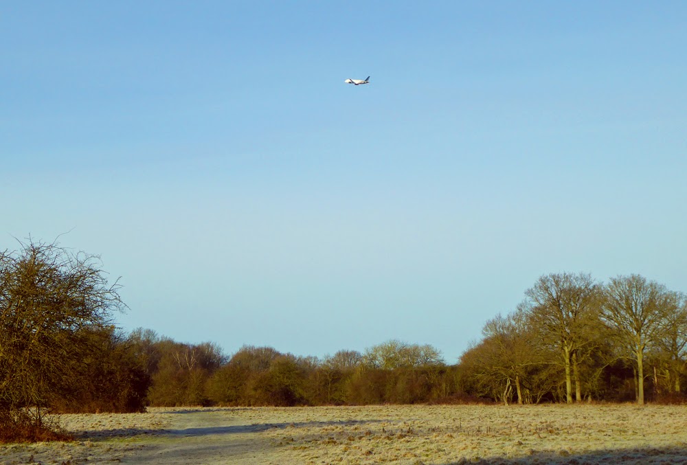
Don’t be put off by the forest’s close proximity to the airport runway.  The planes are only really visible for the first third of the walk and although I noticed the noise initially after about half an hour I forgot about it completely.  It is an interesting contrast of nature and machine when they fly over as you are watching a herd of deer.

Hatfield Forest is close to Stansted Airport

We parked in the first car park which is free if you are a NT member.  There is another car park further into the forest but as we were early this was not open. According to the website the second car park is often shut if the weather has been wet.

Hatfield Forest

The National Trust website gives the directions for the walk we were intending to do.  We went wrong somewhere around point 5-6 and ended up coming back through Street Coppice and out looking across at point 4 again. We went back the way we came walking straight through the woods and 'rides' until we got to point 7. The forest is kept as natural looking as possible so there are very few markers to help!

Deer in Hatfield Forest

Our route should have been: 3.5 miles
Our route was 5.5 miles
See the route on NT website
Terrain: Mostly flat, grass paths and woodland. Boardwalk and gravel drive in places. Parts can get very muddy in the winter or wet weather. Boots advised! Dogs are allowed but must be kept on a lead if livestock are present.
Habitats: Meadows, grassland, woodland, lake, wetlands
Facilities: Car parking (front car park is 24 hr. Parking is free for NT otherwise chargeable); toilets (24hr), shop and cafe (check website for opening times) near the lake. Pubs in Takeley.

Tuesday, 17 February 2015

Swavesey Lake and River Walk Loops (5.2 miles)

This is another of the walks around the RSPB reserve in Swavesey and Fen Ditton.  Part of this route is detailed here as a shorter walk.

We once again started in the car park but you can pick the route up from the guided busway or Swavesey village.

1. Starting in the car park take the gateway ahead and then take a gateway on your right.  Follow the track passing a lake on your right.  When you reach the signpost go through the gate on your right.

2. Follow the bank past the hide with the lake on your right and the river Great Ouse on your left. 

Ferry Mere, Swavesey

3. Eventually you will come to a small lock with a bridge. Go over the bridge and carry on forward down the riverbank.  Again follow the bank keeping the river on your left.  On your left you should see two churches – the spire belongs to Over church and the square tower to Swavesey. 

River Great Ouse towards Over

4. When you find the bank bearing right and the river left continue on and go over a weir and turn right.

River Great Ouse

5. Continue along this bank until you get to a small thicket. We rested for a while here as there is a convenient fallen tree.   After the tree turn right leaving the tall spire of Over church behind.  Continue through a small woodland until you come out in a field and cross over towards the roadway.

6. Once through the gate turn right and walk along the roadway until you reach the guided busway and turn right before crossing the busway.

7. Walk along the busyway with Swavesey church (The Priory) on your left.  Continue on until you reach a small crossing on the track.  Cross over the track and go down slightly before taking a footpath through a gate on your left.

Swavesey Church (The Priory)

8. Follow this path keeping the stream on your left and the meadow on your right.
Continue on until you reach a wider channel.  Climb up to the bank and turn right.  Walk along a short distance until you reach the small lock that you crossed in point 3. Cross the lock and turn left.

9. Follow the bank to the end and go through the gate. Bear slightly right and go down the slope, bearing right at the end, go through the gate.  You will now have a large lake on your right and the busway beyond the hedge on your left.  There are picnic tables along here if you wish to stop.


10. Continue on this track until you reach a busway crossing at the corner of the lake.  Take the track on the right that runs alongside the lake.  Continue until you reach the end and take the gap on the left back to the car park.

Our route was 5.2 miles
See the route on mapometer
Terrain: Flat grassy paths. Can get very muddy in places and some areas prone to flooding. 
Habitats: Meadows, river, lakes.
Facilities: No toilets or other facilities on site. Close to guided busway stops.