Monday, 3 August 2015

Ickworth - Off The Beaten Track (5-6 miles)

Ickworth house and park belongs to the National Trust.  It is free to walk in the extensive grounds.

This route is taken from the website (Off the Beaten Track walk).  I have copied and pasted their instructions as they were pretty good. We ended up walking a bit more due to the field in the section 8 being overgrown (hubby had shorts on and didn't relish being bitten!) and no diagonal path being obvious so we went carried on rather than turning left and followed the wood around the field until we reached the stile .

We also stopped off at the Walled Garden to see the spectacular wild flower meadows. I think from some of the seed heads we might have been a week or two late for the peak but it was still stunning nonetheless.

Wild flowers in the Walled Garden, Ickworth

Lunch was at the restaurant. Slightly disappointing after great previous visits. They have changed the menu and it is not table service any more which means big queues at the counter and a long wait for our food, which seemed overpriced now compared to other NT places we visit.

Route:

1. From the Porter’s Lodge visitor centre take the path opposite towards the Albana Wood, follow the path going through two 5 bar gates. Just after going through the second gate take the path to the right at the small ‘Albana Wood’ stone. Stay on this path until you reach the large green Trim Trail sign, then turn right following the trim trail.

2. As the trim trail goes down a left hand slope and you reach a junction, turn right off the trim trail and leave the woods into an open field. Follow the path down the side of the field with the trees on your right and cross the brook on the wooden bridge.

Sheep at Ickworth

3. Once across the brook, turn right on to the wide track, and shortly through a 5-bar gate. Follow this track until you reach the next 5 bar gate where you will see a cottage beyond the gate and a bridge to your right. Do not go through the gate but turn left and walk up the hill until you intersect the main track and turn left towards Dairy Wood Cottage.

Dairy Wood, Ickworth

4. As you approach the cottage, turn left across the grass and go through the gate in the corner of the field into Dairy Wood. Stay on this track and don’t take any turns or junctions. You will exit the wood briefly and keep on the track as it re-enters near the edge of the wood. The next paragraph covers the loop into Twist and Horsepool wood, so if you wish you could carry straight on, missing out step 5 and re-joining the walk just a few metres further on at the start of step 6.

5. Very soon after you have re-entered the wood look for a barely discernable track/fork to your right. Follow this track which has a ditch on your left as you go gently up hill. Just before you exit the wood cross the ditch to your left and follow the track through the woods. Take the right fork when you intercept another path and you will eventually meander next to some stagnant ponds to your left (great habitat). Keep going until you reach the main path cross roads; turn left for a short distance and left again on a ‘main path’ effectively doubling back into the same woods. Keep on this path until you exit the woods.

Dairy Wood, Ickworth

6. As the path leaves the wood, you will see a clear path between the cropped fields going downhill. Follow the path between the fields to the wide track at the bottom and then turn right. Stay on the wide track for a while. Shortly after passing the ‘White House’ on your right you come to a cross roads. Go straight across the cross roads (stone bridge to your left/cattle grid to your right) following the grass track.

Ickworth Park

7. With the Walled Garden and Canal lake on your left, turn right through the gate approximately at the centre line of the gardens (opposite the summer house), and head up the hill towards the wood-line of Lownde Wood. On reaching the wood, turn left and walk along the front of the wood with the Canal and gardens at the bottom of the slope and to your left.

8. After approximately one third of a mile, you will reach the meeting of a number of fences and gates; go through the gate into the field beyond and then immediately left into the adjacent field. Go diagonally across this field to the opposite corner and cross over the stile onto the path and turn left back towards the walled garden.

Ickworth Park

9. Follow this track until you reach the Walled Garden and turn right keeping the wall of the garden to your left.

The Walled Garden, Ickworth

10. At the end of the Walled Garden take the main road past the church and back up towards the Rotunda and gardens. Go through the 5-bar gate turning immediately right, and enter the Italianate gardens. Enter the West Wing via the orangery and stagger to the restaurant where you definitely deserve a cake or pudding or two.

The official route on the Ickworth website is 5 miles
Our route was 6.25 miles
See the route on mapometer
Terrain: Grass and dirt tracks mostly, moderate climbs in places. Latch gates, kissing gate. Can be muddy in places in wet weather.
Habitats: Meadows, fields (animals grazing), woodland, lakes.
Facilities: Toilets and cafe at Porter's Lodge entrance and at the Rotunda. Rotunda toilets can also be accessed at the back.  Toilets also near the church.

Saturday, 4 April 2015

Rampton - Westwick Circular (6.5 miles)

This walk is a pleasant, and flat, 6+ miles starting in the village of Rampton, going along the guided busway and then through farm land in Westwick to Cottenham Lode, known locally as The Cut before returning to Rampton again.  Parts of the walk are through pasture, arable land and a farmyard so please respect the property, keep dogs on leads near livestock, stick to marked paths and close all gates behind you.  It goes without saying also that parts of this walk can be muddy, especially through the farm.

Starting at The Black Horse pub in Rampton cross over the road and turn right at the edge of the green, then turn right again and walk up King Street.

Guided Busway

Follow King Street right to the end and turn left along Cuckoo Lane.  Walk past some stables on your right and a scrap yard on your left and take the track on the right called Reynold’s Drove.  Follow the track past a bridge on your right, continue until you reach the crossing with the guided busway and take a left along a wide tarmac path.

Follow this straight smooth path, watch out for cyclists using the pathway too, until you eventually reach a crossing with the main road – look out for the painting of a Blue-tit on the house on your left.

At the main road go left towards the tiny hamlet of Westwick and cross over the road entering into the field through the gate. (There is the option here to shorten the walk by about ¾ mile: do not enter the field but follow the road out of Westwick until you reach Lambs Cross Farm).

Fields, Westwick

Once in the field follow the natural path straight on to the end then around to the left. Go through the gate and turn immediately left onto a bridleway.  Follow the path around the edge of the field, continue following the field edge until you can see the main road in front of you, continue along the track to the right running alongside the road until you reach a concrete parking area.

Cross the main road towards the sign for Lambs Cross Farm and follow the track towards the farm house.  Continue past the farm house and through the yard.

Lambs Cross Farm, Westwick

Go through a gateway (bear in mind this is a working farm so please stay on the path and allow for farm vehicles). Follow the track ahead as it slopes upwards. Continue on past fields until eventually you come to a bridge.

Cottenham Lode (The Cut)

Go over the bridge and keeping the water (Cottenham Lode, or The Cut) on your right continue on until you reach another bridge and the main road.  Cross the road and turn left and continue into Rampton.  Go past the green on your left until you are back at The Black Horse pub.

Our route was 6.4 miles
See the route on mapometer (6.1 miles)
Terrain: Flat, tarmac, grass. Can be muddy. Some gates.
Habitats: Villages, busway, meadow, farm yard and arable, river.
Facilities: The Black Horse public house, Rampton. No public toilets on route.
DOWNLOAD the step-by-step route

Saturday, 28 March 2015

Rampton to Cottenham Circular via Cottenham Church and Archie's Way (6 miles)

This walk takes parts of other shorter walks between Rampton and Cottenham with a couple of additions to add on some miles. As with lots of these walks if you check the map you can combine and/or remove some sections depending on requirements.

Starting at The Black Horse Pub in Rampton walk towards the village green and carry on out of the village, past the Village Hall on your right and the church on your left. 

When you reach a white bridge take the footpath on the left alongside the water.  On the map this is marked as Cottenham Lode but you may hear locals refer to it as The Cut.  Follow the grass footpath as it bears right and continue onwards with Cottenham church in front of you.  When you reach a roadway and another bridge cross over the road and continue through the gate that is ahead of you.

Cottenham Church visible from Cottenham Lode (The Cut)

Follow the footpath keeping the water on your right, go through two metal gateways until you reach a road.  Turn right and follow the road past a white house on your left.  Carefully cross over the main road to the path on the other side and continue right towards Cottenham, stopping at a bench in the churchyard on your left for a rest if you wish.

The dark fertile fen soil alongside Cottenham Lode (The Cut)

With the church behind you continue on down the High Street.  You will pass The Jolly Millers pub on the left.  When you reach a small grass area at a mini roundabout take the right hand turn down Broad Lane.  Follow the road past houses and then after the industrial units take the right hand turn.  If you go into the new housing estate you have gone too far.

Continue down the track past a small nature reserve on your right and then a farm on your left.  You will now reach the second of the bridges you saw earlier and you have the option of turning left and going back along The Cut the way you came (this will reduce the walk by about a mile or so) or continuing onwards down Great North Fen Drove, the narrow concrete roadway ahead.  The rest of these instructions take this second route.

Follow the Drove past a small farmhouse and continue on when the road becomes a grass bridleway.  This is Archie’s Way.  Continue over the small bridge and follow the grass path as it bears right and then left.  Continue straight on and then bear right.  When you reach a concrete track turn left.

Continue along the road as it bears left and then carry straight on until you come to some houses and then bungalows.  Eventually you will reach Rampton High Street again, turn right and the Black Horse Pub is on your right.

Our route was 6 miles
See the route on mapometer
Terrain: Flat, grass footpaths or concrete/tarmac, can be uneven in places and muddy when wet. Some gates.
Habitat: Rural, farmland, waterways, village
Facilities: Black Horse pub Rampton, Jolly Millers pub Cottenham. Other shops and pubs in Cottenham (off route)

Sunday, 8 March 2015

Coton Nature Reserve, Cambridgeshire (4 miles)

Coton Nature Reserve is fairly new, about 10 years old in fact, and covers over 300 acres of farmland including arguable one of the best views of Cambridge – something of an achievement in this flat part of the country!

The reserve has lots of walking possibilities and the reserve map plots a few routes.  We wanted something a bit longer so combined a few of them taking in most of the reserve.  There are also possibilities for longer walks continuing outside the reserve on footpaths.

We parked up in the Martin Car Park, just off junction 12 of the M11.

Coton Nature Reserve

Route:

Take the gateway round the pond on the right to a concrete track and head away from the entrance road.

When you come to a gap in the hedge on the right follow this track round the field (following the orange walk on the reserve map), along the motorway edge and when you come to a small bridge on your left go over.

Carry on straight ahead until you come to a gateway and go out crossing the road.  Go into the next field, turning left and along the track that takes you up a slope.

Rifle Range

As you go up you should see a rifle range in front of you.  (There is a footpath that goes to Barton that crosses the range but if the red flag is flying you must not cross.)  Turn right at the signpost hut and continue up Red Meadow Hill.

At the top turn right and walk along until you come to some steps, take the steps and go through the gate to the top of the hill.  Here you can see across to Cambridge picking out Kings College Chapel, the University Library tower and St John’s Chapel along with the chimney of the Museum of Technology.  It is said that on a very clear day you can see Ely Cathedral.

Views towards Cambridge from Red Meadow Hill

At the top of the hill go left through the gate and turn right and walk back down along the side of the field.  At the bottom bear left and cross the bridge and turn left onto the permissive footpath of Rectory Farm. 

View towards Coton coming down Red Meadow Hill

Follow the track and turn right at the end, walking along the edge of a small woodland area.  At the end of this track turn right again at the signpost and walk along the field going straight on at the end and then right into a woodland.  Follow the narrow path through the trees until you come out back onto the field and turn left. (You can miss out the wood here and continue alongside the field)

Follow the track to the end and then right until you reach a gate on your left. Go through the gate into Manor Field crossing straight ahead. Go past the water recycling centre and out of the gate at the end.

Continue on until you reach the road, crossing here carefully. Go into the next field and walk straight on until you come to Clarke’s Bridge. Cross the bridge and go through the gates.  Walk a few steps and take the gateway on your left.

You are now following the pink walk on the reserve map.  Walk ahead and take the gate on your right into Rowan’s Field.  You can either go straight ahead here towards the cream house or go left around the young woodland.  Either way go past the house and right along side the field.  The recreation ground will be on your left through the hedge.

At the end of the hedge turn right and walk down the concrete track.  Go through the gateway at the end and bear right through the gap in the trees and then left. 

Follow the path bearing left until you meet the concrete track again.

Turn right and walk back towards the car park.

Our route was 4 miles
See the route on mapometer
Terrain – Mostly easy going on grass tracks. Slope and steps up to Red Meadow Hill. Gates and bridges. Some muddy areas. Could be animals grazing.
Habitat – Small pond, farmland, stream. Meadows.

Facilities – Car park, no toilets or refreshments. ThePlough at Coton.

Sunday, 22 February 2015

Hatfield Forest, Essex (3.5 miles)

Needing to drop our daughter off for an early flight to Rome from Stansted Airport we thought we’d make the most of the early start and explore Hatfield Forest just a few miles away.

Hatfield was once a medieval royal hunting forest now owned by the National Trust.  This large site has numerous possibilities for walks but as it was our first visit I downloaded a 3.5 mile route from the website.   Needless to say despite the instructions and a map we got lost and ended up doubling back and going off track enough to add a further 2 miles to the walk!

Although we visited in February and most of the trees are deciduous and bare it was a cold and frosty morning and the parkland looked beautiful in the early rising sunshine.

Early sunshine at Hatfield Forest

There are lots of deer in the forest and we were lucky enough to see quite a few, although mostly in the trees and they always saw us before we saw them!

Deer at Hatfield Forest

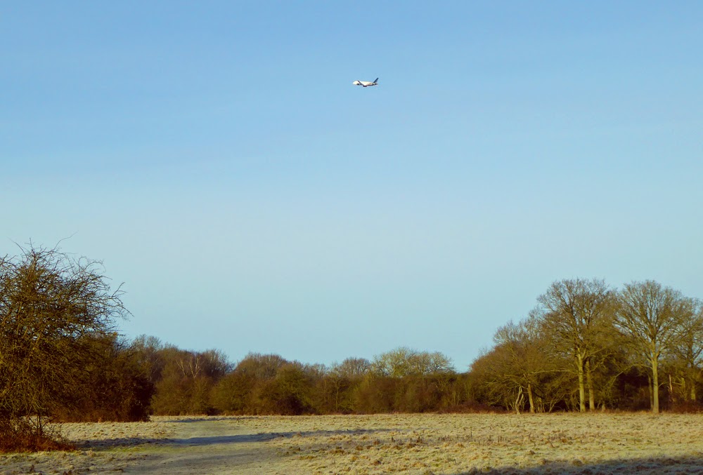
Don’t be put off by the forest’s close proximity to the airport runway.  The planes are only really visible for the first third of the walk and although I noticed the noise initially after about half an hour I forgot about it completely.  It is an interesting contrast of nature and machine when they fly over as you are watching a herd of deer.

Hatfield Forest is close to Stansted Airport

We parked in the first car park which is free if you are a NT member.  There is another car park further into the forest but as we were early this was not open. According to the website the second car park is often shut if the weather has been wet.

Hatfield Forest

The National Trust website gives the directions for the walk we were intending to do.  We went wrong somewhere around point 5-6 and ended up coming back through Street Coppice and out looking across at point 4 again. We went back the way we came walking straight through the woods and 'rides' until we got to point 7. The forest is kept as natural looking as possible so there are very few markers to help!

Deer in Hatfield Forest

Our route should have been: 3.5 miles
Our route was 5.5 miles
See the route on NT website
Terrain: Mostly flat, grass paths and woodland. Boardwalk and gravel drive in places. Parts can get very muddy in the winter or wet weather. Boots advised! Dogs are allowed but must be kept on a lead if livestock are present.
Habitats: Meadows, grassland, woodland, lake, wetlands
Facilities: Car parking (front car park is 24 hr. Parking is free for NT otherwise chargeable); toilets (24hr), shop and cafe (check website for opening times) near the lake. Pubs in Takeley.